Searching for the Buncombe Turnpike
Prologue
Michael Arrowood is a lifelong resident of Henderson County whose interest in local history began long before he founded Explore Henderson County. Growing up on Oak Grove Road in East Flat Rock, Arrowood spent much of his youth exploring the woods, old roads, and backcountry paths of Henderson County. Along the way, he frequently encountered remnants of the area’s earliest transportation routes - faded roadbeds, abandoned crossings, and traces of long-forgotten mountain roads.
Over time, Arrowood combined his familiarity with the landscape and his interest in local history into a business that offers guided walking tours, driving tours, and step-on bus tours throughout the region.
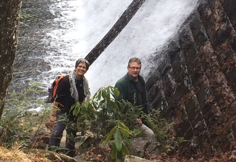
Recently, I sat down with him to discuss a question that has intrigued me for years: Where exactly did the Buncombe Turnpike run through Henderson County?
The road played a major role in the development of Flat Rock as a summer colony and served as one of the county’s most important nineteenth-century transportation and commercial corridors.
What follows represents Michael Arrowood's current interpretation of the Buncombe Turnpike's path through Henderson County based on historical documents, maps, surviving evidence, and local historical research.
--
Searching for the Buncombe Turnpike
Historic Marker at the entrance to the Dunroy Neighborhood in Flat Rock
Long before formal roads existed in western North Carolina, Native American tribes established trails through the mountains that later became the foundation for many of the region’s transportation corridors. These routes generally followed river valleys, lightly forested ridgelines, shallow crossings, and mountain gaps that provided the most practical passage through rugged terrain.
Early settlers relied heavily on these existing pathways. Many later roads - including the Drover’s Road, Old State Road, and eventually the Buncombe Turnpike – frequently followed the routes first established by Native Americans. Still, travel through the mountains remained difficult well into the early nineteenth century. Methodist Bishop Francis Asbury, traveling through the present-day Henderson and Rutherford counties in 1806, described mountain roads so harsh that “bad is the best” one could expect to find.
One critically important corridor crossed the Blue Ridge at Saluda Gap, one of the lowest and most accessible mountain crossings between South Carolina and western North Carolina. Located just 8 miles south of Flat Rock Village Hall, Saluda Gap would ultimately serve as the portal to the future of Flat Rock.
Saluda Path
By the late eighteenth century, increasing settlement in western North Carolina created demand for more reliable wagon roads through the mountains. In 1793, South Carolina merchant and mill owner John Earle was contracted to build a wagon road connecting Saluda Gap to the southern portion of Buncombe County at a cost of $4,000.
The route, later known as the Saluda Path, extended north from Saluda Gap through present-day Flat Rock to the Cane Creek crossing near present-day U.S. 25 in Fletcher. “Earle was just steering by the creeks because there wasn't a town of Fletcher and no town of Hendersonville,” Michael explains. “He was making a rough track through the wild country and meandering around the wetlands and sloughs that were common in this region.”
Earle’s Saluda Path in North Carolina connected to an 11-mile section of South Carolina’s State Road referred to as the Saluda Mountain Road. The SC section featured a final steep and twisting section just before the North Carolina state line called The Winding Stairs and connected travelers out of Greenville and Traveler’s Rest with western North Carolina.
Completed around 1800, Saluda Path passed Earle’s grist mill in Flat Rock (located at the dam for the present-day Highland Lake) and became one of the earliest significant wagon roads in western North Carolina. Farmers, settlers, and drovers used the route to move livestock and goods between the mountains and South Carolina markets.
Earle’s Saluda Path would eventually be incorporated into the southernmost section of the Buncombe Turnpike.
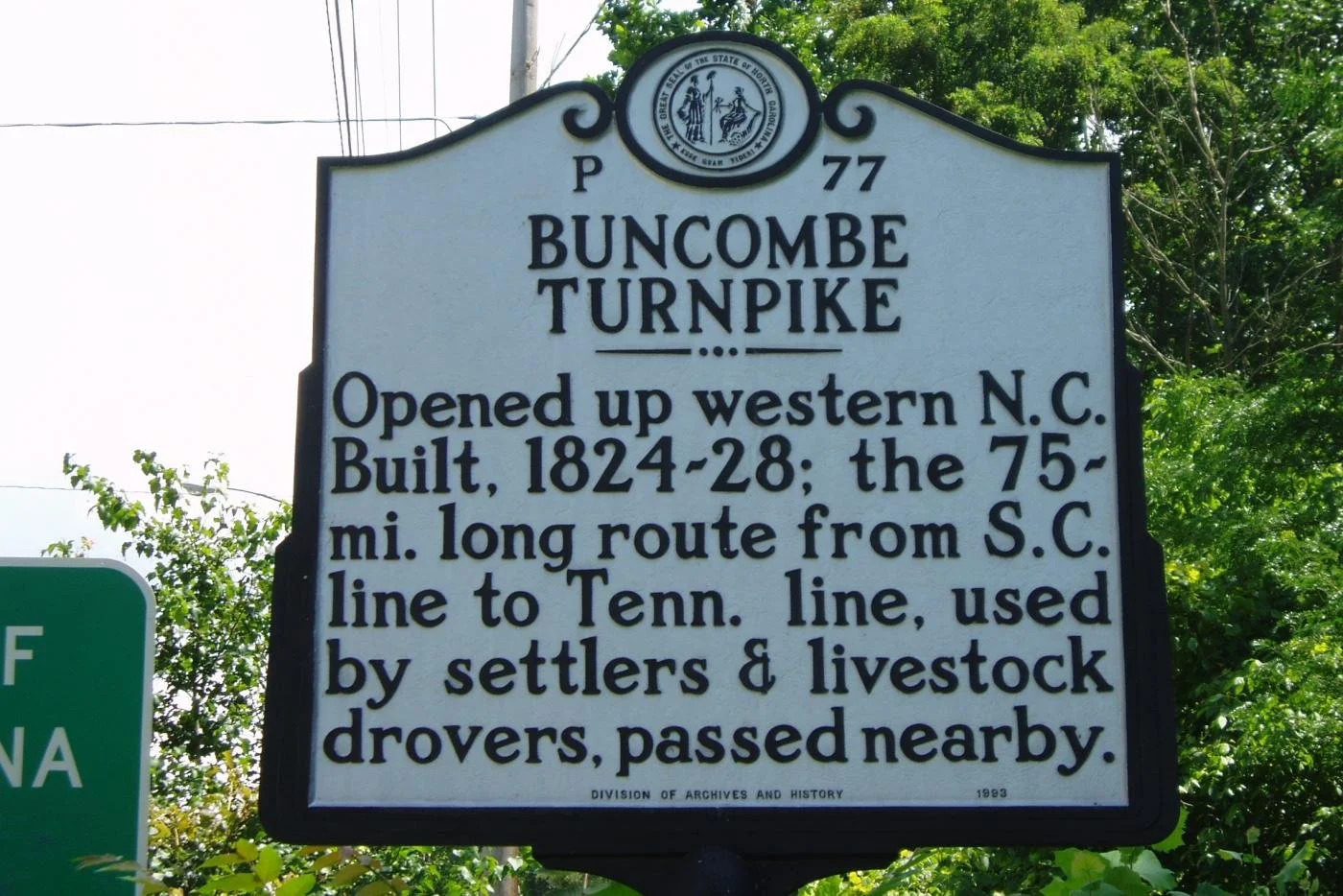
Building the Buncombe Turnpike
A stockstand on the Buncombe Turnpike
By the 1820s, increasing settlement, livestock production, and trade created demand for further improvements for transportation in western North Carolina. Leaders in Buncombe County sought a road capable of handling wagons, mail delivery, stagecoaches, and livestock traffic between eastern Tennessee, western North Carolina, and the South Carolina markets.
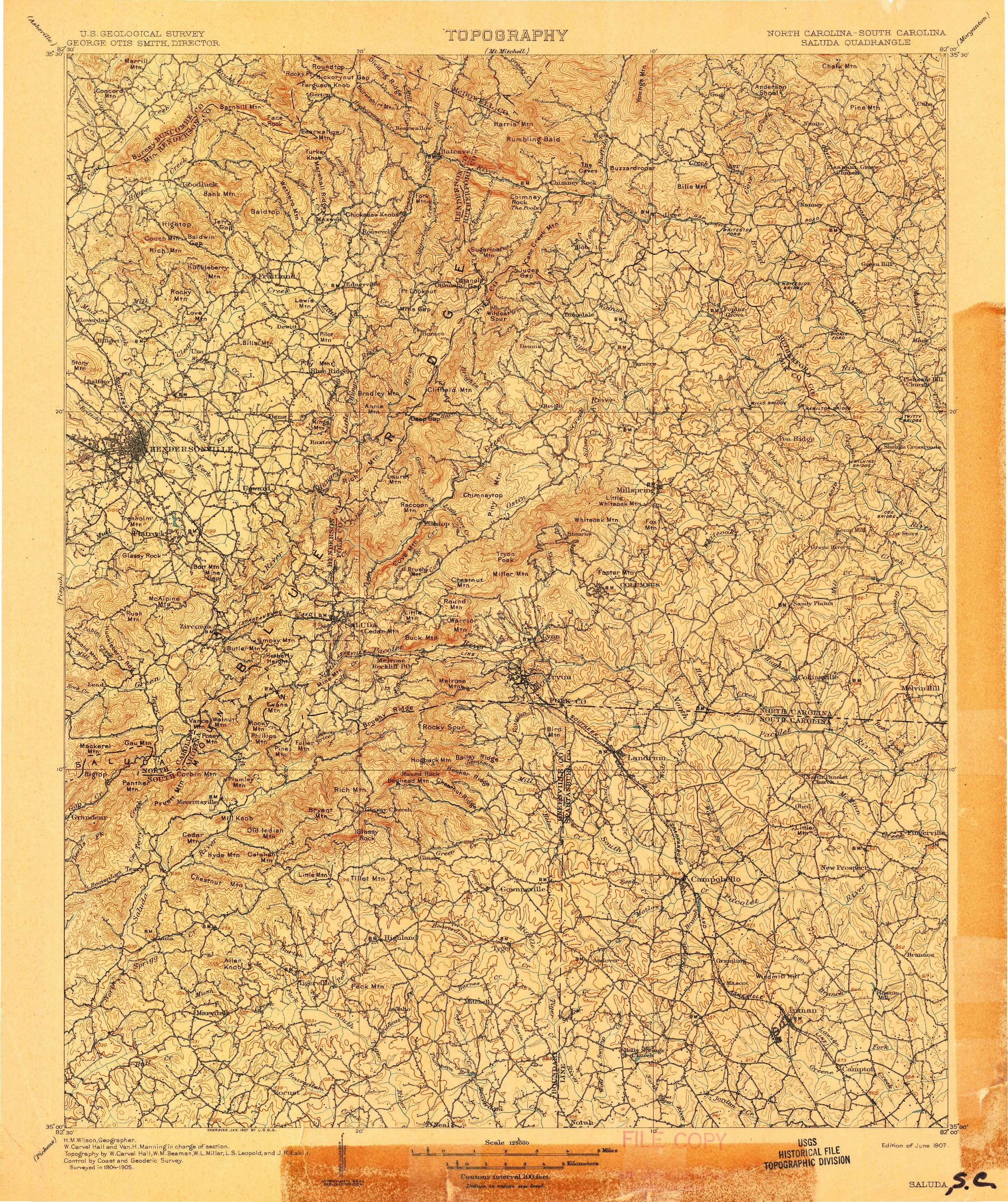
In 1824, the North Carolina General Assembly incorporated the Buncombe Turnpike Company. Asheville businessmen James Patton, Samuel Chunn, and George Swain were authorized to raise $50,000 through stock sales to finance construction of the road. The project improved and expanded portions of the existing Drover’s Road, connecting Tennessee with Asheville and the Saluda Path. The resulting 75-mile toll road extended from Saluda Gap, north through Flat Rock, Hendersonville, and Asheville, before continuing toward Tennessee along the French Broad River. Construction was completed in 1828.
Rather than constructing an entirely new roadway, builders generally improved and widened older routes already in use through the mountains. It was considered to be a “first-class” toll road that was at least 12 feet wide with a dirt and gravel surface. Grades were reduced where possible, and low, muddy sections were reinforced with “corduroy roads” made from logs laid side-by-side. Most importantly, it was regularly maintained and properly drained.
Wooden mileposts marked distances along the route, and toll gates were placed approximately every ten miles. “So that's important. The businessmen were allowed to sell $50,000 in stock, and they paid their shareholders with money from the tolls,” says Michael.
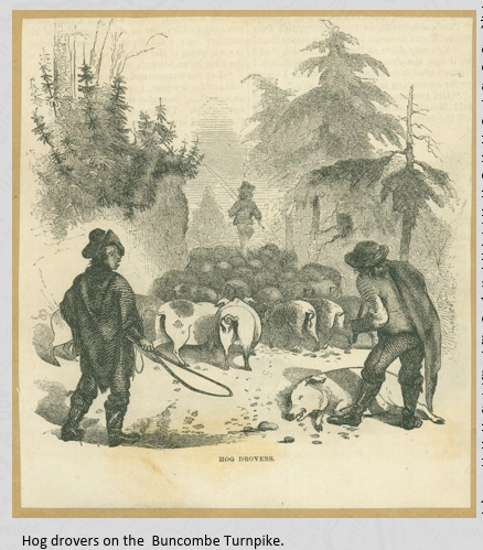
Tolls were based on the type of traffic using the road. Horsemen paid about twenty cents, while wagons and carts were charged according to size. Livestock drovers paid by the head for animals driven along the route. During the fall driving season, large herds of hogs, cattle, sheep, horses, and mules moved south toward markets in Charleston, Columbia, and Augusta. “From October to December every year,” says Michael, “hundreds of thousands of cattle, hogs, turkeys, and even geese, moved down to market.”
Inns, taverns, and stock stands quickly developed along the turnpike to serve drovers and travelers. These establishments provided lodging, food, stables, and livestock pens. Some stock stands handled thousands of animals during peak driving seasons. One traveler reported spending the night at an inn with 5,000 hogs and 75 people, while another stand owner claimed to have fed more than 100,000 hogs in a single month.
The Turnpike Through Flat Rock
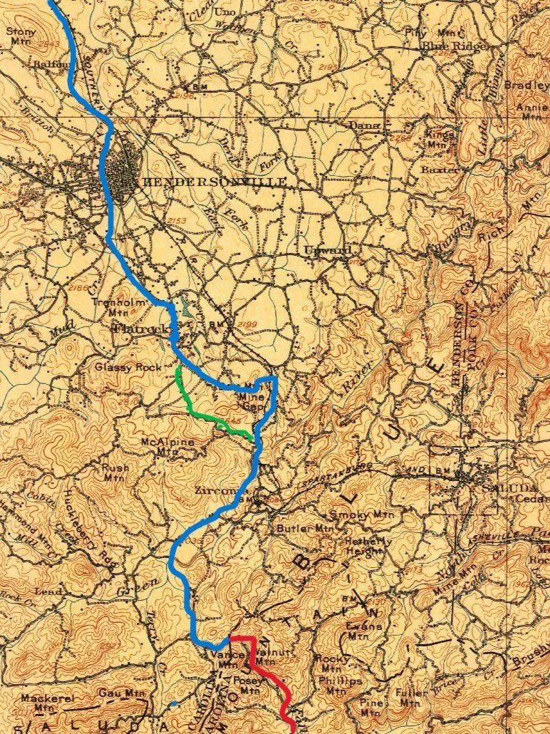
The BLUE line is the approximation of what I believe was the original 1828 route. The RED line is the continuation of the State Road into South Carolina. The GREEN line is the route of present-day 225 through the "deep cut" south of Pinnacle Mtn. Road and before the Zirconia Post Office. - Michael Arrowood
The exact route of the Buncombe Turnpike through modern-day Henderson County has been lost to the passage of time as new roads and development supplanted portions of the road or left other sections to be abandoned and reclaimed by the overgrowth of local vegetation.
Making its way south from Asheville, the turnpike cut a path across a low rise known as Chinquapin Hill. This section of the turnpike would eventually become the site of Hendersonville -established two decades later in the 1840s. Before Hendersonville was established, Henderson County was formed in 1838 from the southern portion of the original Buncombe County. In 1841, Judge Mitchell King of Flat Rock gave 50 acres of land – along with 29 acres from John Johnson and James Brittain - and city streets were laid out for the new county seat. In 1842, the first Henderson County courthouse was constructed. The Buncombe Turnpike served as Main Street for the new town.
The Henderson County portion of the turnpike generally followed the current route of Business US 25 north of Hendersonville. By the time the road reached the southern edge of the city, however, road builders would have encountered low lying land that was very boggy and prone to frequent flooding – an occurrence well understood even today, as the intersection of Greenville Highway and Spartanburg Highway still floods to this day. Michael Arrowood believes the original turnpike would have detoured around this flood-prone topography.
“My best estimate is that they did not go straight south, where the Greenville Highway goes today. It went out what is now the Kanuga Bend and continued south to present-day Erkwood Drive. They went up Kanuga to get to an easy ford across Mud Creek.
From there, it went down Erkwood, where there's a surviving section at the entrance to the Dunroy neighborhood. It passed near Mud Creek Baptist, which had been established 20 years before. After that, it continued down Rutledge Road – before there was St. John in the Wilderness - and turned south again on what is now Greenville Highway, approximately. From there, it is clearly documented that the 1847 Historic Flat Rock Post Office jutted out into the Turnpike.”
Continuing south from the Flat Rock Post Office, it is more difficult to track the exact route of the turnpike, but Michael believes that the road would have turned slightly eastward to cut through the Argyle property of Judge Mitchell King (on the eastern side of Greenville Highway opposite the present-day Kenmure subdivision). Traversing the Argyle property, the road wound its way over to Mine Gap between Butt Mountain and King Mountain on the backside of the Claremont and Kingcrest neighborhoods. “Earle's Saluda Path went across Mine Gap. I lived on Mine Gap Road for about 16 years and explored the woods very thoroughly. There was clear evidence of the old stagecoach road descending northwest toward Argyle,” says Michael.
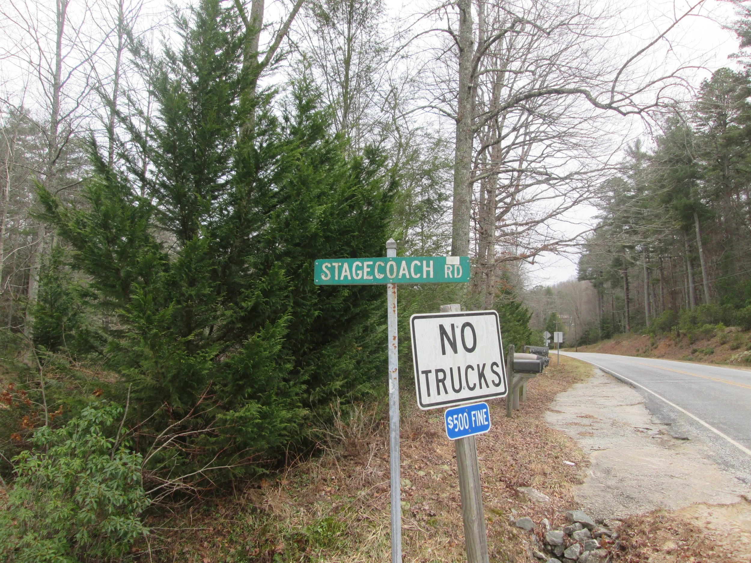
From Mine Gap, the turnpike traveled through present-day Zirconia, and Michael believes it approximately followed the path of U.S. 225 (Old 25) through Tuxedo, crossing the Green River upstream from Lake Summit. From there, it wound its way through the wooded terrain to get to the NC/SC state line at Saluda Gap. Just north of the gap, there is still a Stagecoach Road that harkens back to the early roads that carried settlers and visitors from SC into western NC.
Michael is quick to point out that using current roadways to describe the true path of the Buncombe Turnpike is never more than a close approximation of the route. “All this is just approximate - there has been much grading and straightening done to produce the modern roads. I have no doubt that some other Turnpike sections are still out there in the woods, slightly off the path I am suggesting.”
Economic Impact of the Turnpike
The Buncombe Turnpike connected western North Carolina to larger commercial markets in South Carolina, Georgia, Tennessee, and Kentucky. Before construction of the road, much of the mountain economy depended upon subsistence farming because transportation over the mountains was slow and unreliable. The improved road allowed farmers and drovers to transport livestock and agricultural products more efficiently to market.
Businesses supporting this trade - including inns, blacksmith shops, wagon repair shops, and stock stands - developed along the route. Demand for corn to feed livestock at roadside stands also increased significantly, making corn one of the region’s earliest important cash crops.
Michael explains:
“Stock stands had to be established every four to six miles. I learned in my research that a hog can walk about six miles in a day. The need to feed livestock at the stock stands created a market for local farmers who started raising corn as the first cash crop in western NC. They would sell corn by the bushel to the tavern or stock stand owner, who in turn would make a profit on selling it to the drovers. The drovers would get a meal and put their blankets on the floor in a great room to sleep. They were very rough accommodations.”
The improved transportation corridor also supported regular mail service, stagecoach travel, and tourism. Easier access to the mountains encouraged seasonal travel to Flat Rock and Asheville decades before railroad construction. “The economy started rolling, and you had regular stagecoach service between Greenville and Asheville,” Michael explains. “You left Greenville at 4 a.m. and arrived in Asheville around 9 p.m. That would have been a bone-jarring, long, hard day.”
The Decline of the Buncombe Turnpike
Map of the Dixie Highway which ran through Hendersonville and Flat Rock.
By the early 1850s, heavy traffic and poor weather had damaged portions of the Buncombe Turnpike. In 1851, the North Carolina legislature chartered the Asheville and Greenville Plank Road Company to improve transportation between Asheville and Greenville, South Carolina. Portions of the existing roadway were rebuilt using wooden planks to create a smoother surface for wagons and stagecoaches.
A raised half-mile causeway was built south of Hendersonville to help travelers cross the low and wet ground, rather than following the earlier route believed to have passed through Kanuga and Erkwood. This construction provided a more direct route from Hendersonville to Flat Rock and beyond. Michael believes that the plank road may have continued as far south as the historic Flat Rock Post Office.
Like many plank roads built during the period, maintenance proved difficult and expensive. Heavy rains, mud, and constant traffic caused rapid deterioration of the wooden roadway. During the Civil War, portions of the road came under military control, and maintenance declined further. By 1881, the Asheville and Greenville Plank Road Company had dissolved, and the remaining sections of the road were transferred to local governments.
Railroad construction in western North Carolina during the late nineteenth century reduced the importance of the Buncombe Turnpike as a commercial transportation route. Rail service reached Hendersonville in 1879 and Asheville in 1880, providing faster and more efficient transportation for freight and passengers.
As commercial traffic shifted to the railroad, livestock drives along the turnpike declined sharply. Inns, stock stands, and other businesses that depended upon drover traffic also declined. Although portions of the road remained in local use, the Buncombe Turnpike had largely lost its role as the primary transportation corridor through the mountains by the 1880s.
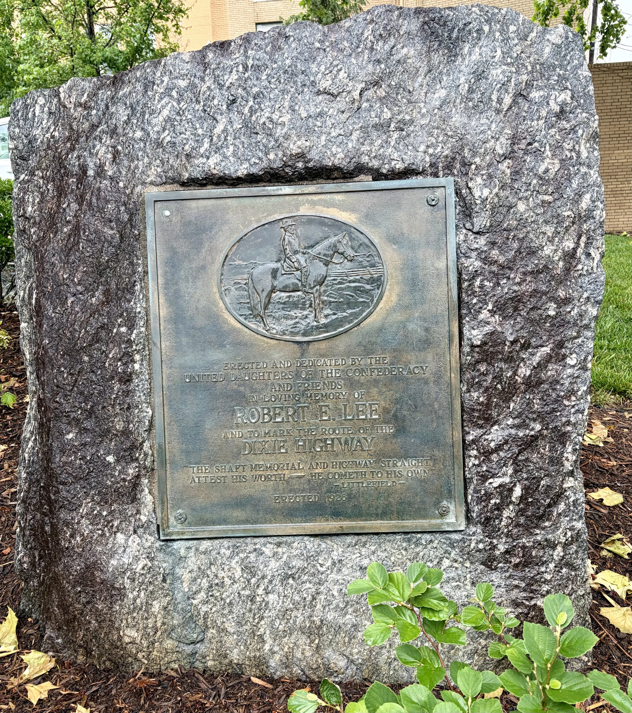
With increased automobile travel in the early twentieth century, regional highway systems were developed to connect northern and southern states. This led to the construction of the Dixie Highway, established in 1915 by local chambers of commerce and highway boosters, before the United States had a national highway system.
In Henderson County, the Dixie Highway largely followed the same corridor previously used by the Buncombe Turnpike, passing through Asheville, Main Street in Hendersonville, Flat Rock, Zirconia, Tuxedo, and continuing south to Greenville. “The Dixie Highway went right down Main Street in Hendersonville because local municipalities wanted the business generated by tourists traveling through,” explains Michael.
Conclusion
Much of the original route of the Buncombe Turnpike has disappeared beneath modern highways, commercial development, neighborhoods, and changing landscapes. In some places, traces of the old road still survive as quiet stretches of secondary roads, forgotten roadbeds, or subtle curves in today’s highways. In other places, its precise course has faded into uncertainty and memory.
The road itself may have faded, but the corridor never disappeared.
The Buncombe Turnpike no longer exists as a named road, but its influence remains visible across Henderson County. Thousands of people travel portions of its former route every day without realizing they are following pathways once used by Cherokee hunters, settlers, livestock drovers, stagecoaches, and summer visitors heading into the mountains. While much of the road itself has been altered or lost, the corridor it created continues to shape how people move through the region.
###
Michael Arrowood
About Michael Arrowood
Michael Arrowood is a lifelong resident of Henderson County - but he's also gotten out in the world and seen a few continents. After spending a decade in group sales and visitor services, Michael now offers step-on tours for buses, a wide variety of guided walking and driving tours, and other services.
Learn about Explore Henderson County NC here.
Sources for this Article
The Buncombe Turnpike; Kelly Coffey
Flat Rock Historic District, Boundary Increase, Boundary Decrease, and Additional Documentation
Hendersonville Historic Preservation Commission
North Carolina History Project: Plank Roads: https://northcarolinahistory.org/encyclopedia/plank-roads/
NCpedia.org - Buncombe Turnpike - https://www.ncpedia.org/buncombe-turnpike