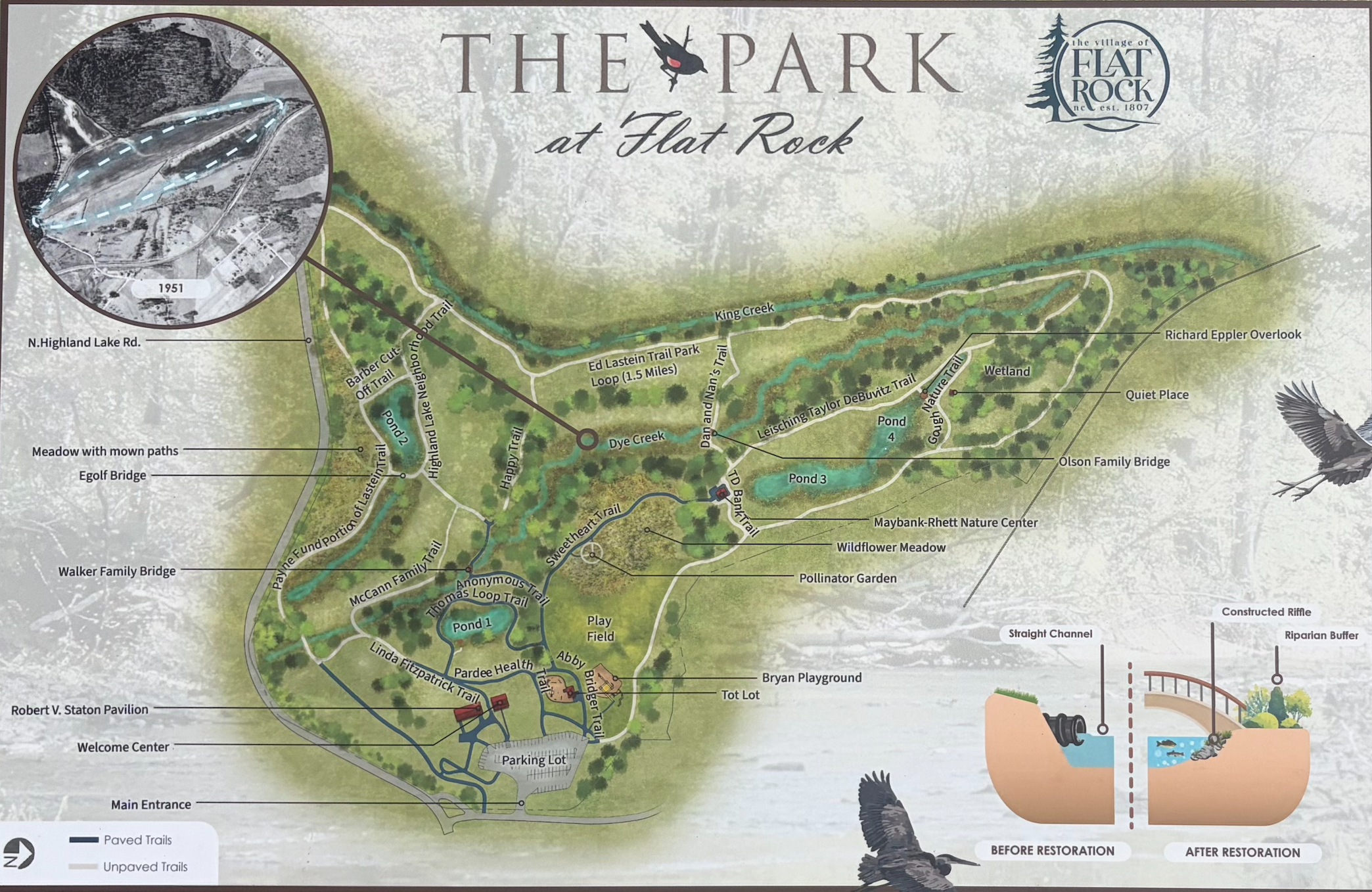
The Land Beneath the Trails
The History of The Park at Flat Rock and the Restoration of Dye Creek
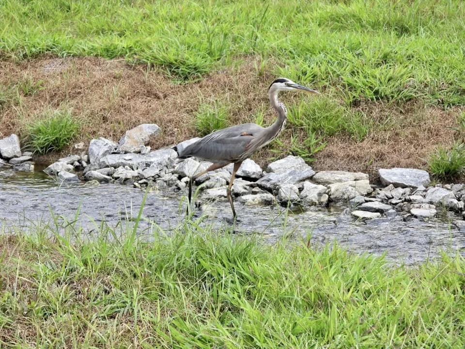
A Great Blue Heron enjoying the Dye Creek restoration.
Long before walkers enjoyed the trails at The Park at Flat Rock and before golfers strolled rolling fairways, the land was something altogether different. Until the late 1700s, it was a broad mountain wetland shaped by the slow movement of water through bogs, creeks, and marshy lowlands at the edge of what we now know as King Creek. Dye Creek, sometimes called Dye Branch, wandered naturally through the soggy landscape, feeding a rich ecosystem that existed centuries before the first settlers arrived in Flat Rock.
Over time, however, the property would be transformed again and again — first by dams and mills, then by grand summer estates, agriculture, golf courses, and finally by an ambitious village project that created one of the most beautiful and successful parks in Henderson County.
Today, visitors to The Park at Flat Rock are witnessing yet another chapter in that long evolution. The recent Dye Creek Restoration Project seeks not merely to improve a stream, but to reverse decades of environmental alteration that had forced the creek into an artificial straight channel for farming and development.
A Landscape Constantly Reimagined
Long before Flat Rock became known for grand summer estates, the land surrounding present-day Highland Lake and The Park at Flat Rock was part of an extensive wetland system fed by King Creek and smaller tributaries like Dye Creek. The area’s boggy ground, slow-moving water, and marshy lowlands supported wildlife and native vegetation for centuries.
That landscape began to change after the American Revolution, when veterans and settlers moved into the area that would eventually become Henderson County. Among the earliest settlers was John Earl, who received a land grant in the late eighteenth century and established lumber and grist mills along a shoal on King Creek. By 1789, the creek had been dammed to create what later became known as Highland Lake, dramatically reshaping the environment and opening the land to milling, agriculture, and further settlement
Throughout the nineteenth century, the property passed through the hands of several prominent owners, including Henry McAlpin, Charles Baring, and, later, George Trenholm and the Rhett family of South Carolina. As Flat Rock emerged as a summer refuge for wealthy Lowcountry families escaping coastal heat and disease, the land surrounding Highland Lake gradually evolved from frontier mill property into part of the region’s expanding estate culture. Elegant homes, cottages, and landscaped grounds appeared around the lake, while the creeks and lowlands continued to define the natural character of the property.
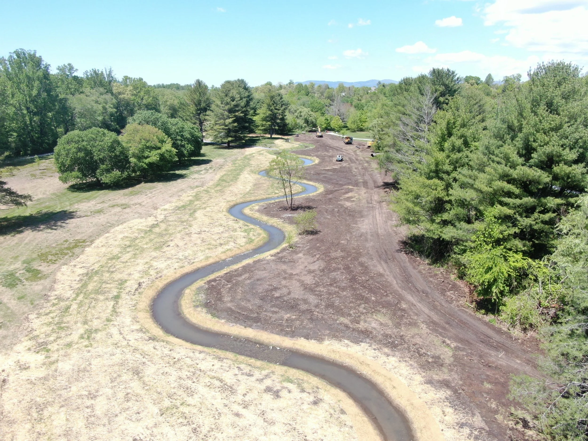
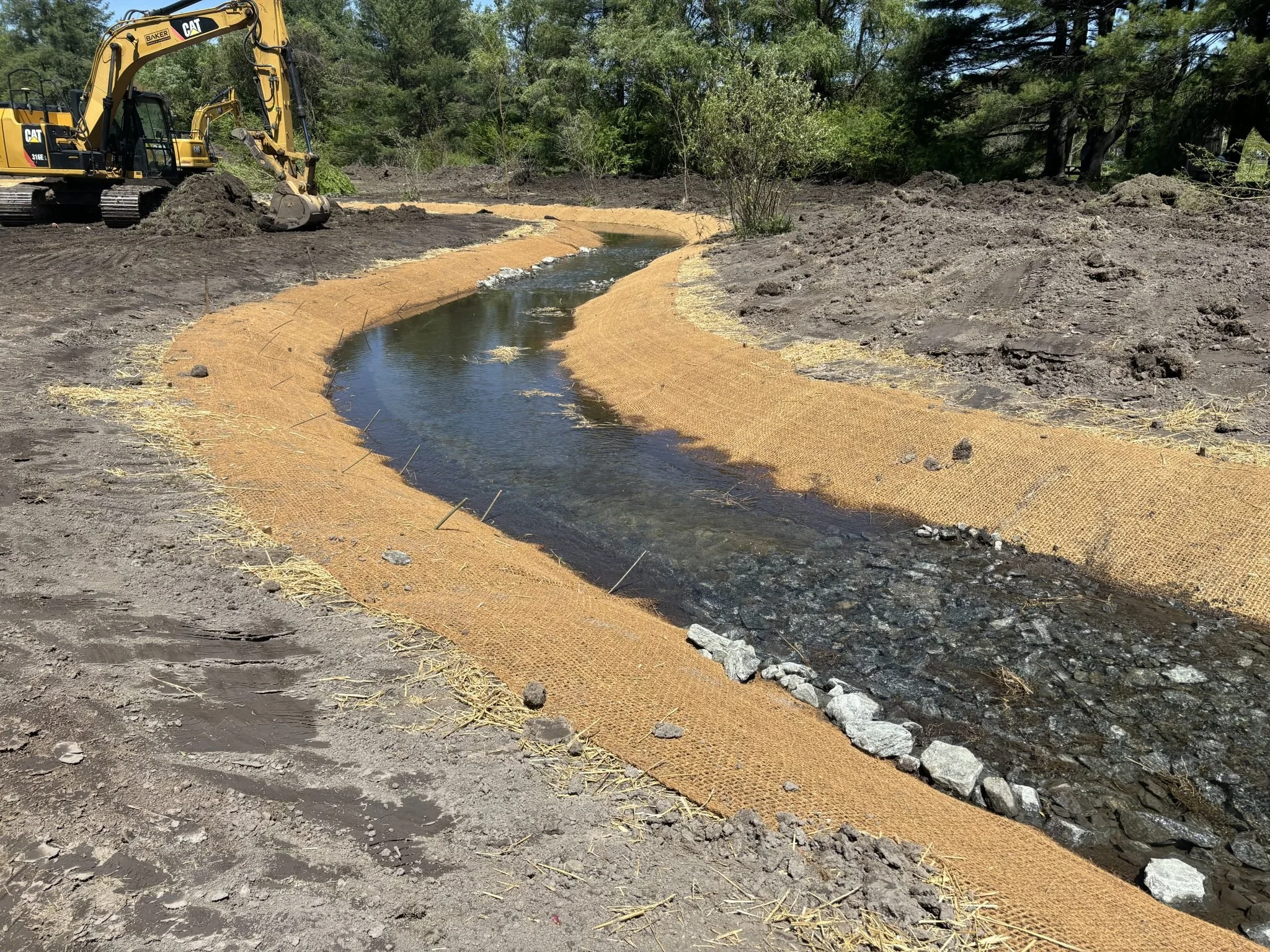
Dye Creek after restoration.
A dramatic new chapter began in 1910 with the creation of the Highland Lake Club. Organized by Joseph Holt and a group of South Carolina investors, the club purchased nearly 500 acres and envisioned an upscale mountain resort unlike anything western North Carolina had yet seen. Highland Lake was enlarged for boating and fishing, tennis courts were constructed, and nationally known golf architect John Ingels designed an eighteen-hole golf course — one of the earliest mountain golf courses in the region. The first nine holes occupied much of the land that today forms The Park at Flat Rock.
The club’s grand ambitions, however, proved short-lived. After only two seasons, the clubhouse burned and the venture collapsed. During World War I, much of the property was acquired by Colonel John Charles Woodward, who established the Carolina Military and Naval Academy for boys on the former resort grounds.
By the middle of the twentieth century, portions of the land had shifted once again, this time into agricultural use. Historical timelines associated with the park identify the area as becoming a corn field during the 1950s. To improve drainage and make the land more usable, sections of Dye Creek were straightened and channelized. What had once been a naturally winding stream increasingly resembled a drainage ditch, a change that would have long-term consequences for the health of the creek and surrounding wetlands.
In 1979, the property entered another recreational phase when Highland Lake Golf Club opened a new nine-hole course on the site. For decades the golf course preserved much of the land as open space, though the altered creek corridor continued to deteriorate through erosion, sedimentation, and loss of habitat.
The next major turning point came in 2013, when the Village of Flat Rock purchased the former golf course property with the vision of creating a public park. Supported by grants and conservation partners, the village transformed the aging golf course into The Park at Flat Rock — a place dedicated not only to recreation, but also to conservation, community gathering, and environmental stewardship.
Today, The Park at Flat Rock reflects nearly every chapter of the property’s long history. Beneath its trails and open meadows lies the story of a landscape repeatedly reshaped by changing ideas about land, water, recreation, and community — from mountain bog to mill pond, from resort destination to farm field, from golf course to restored public greenspace.
Restoring Dye Creek
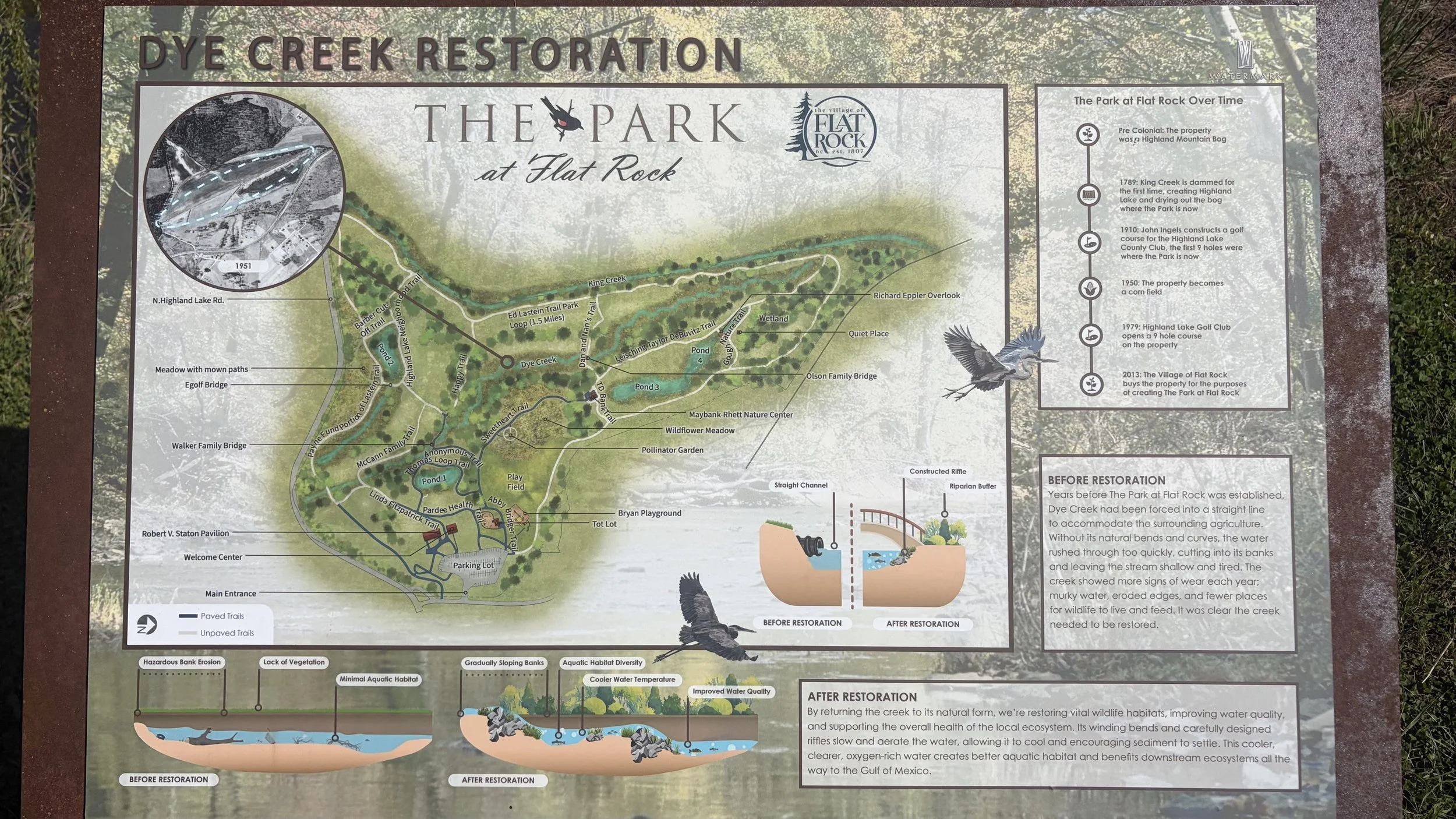
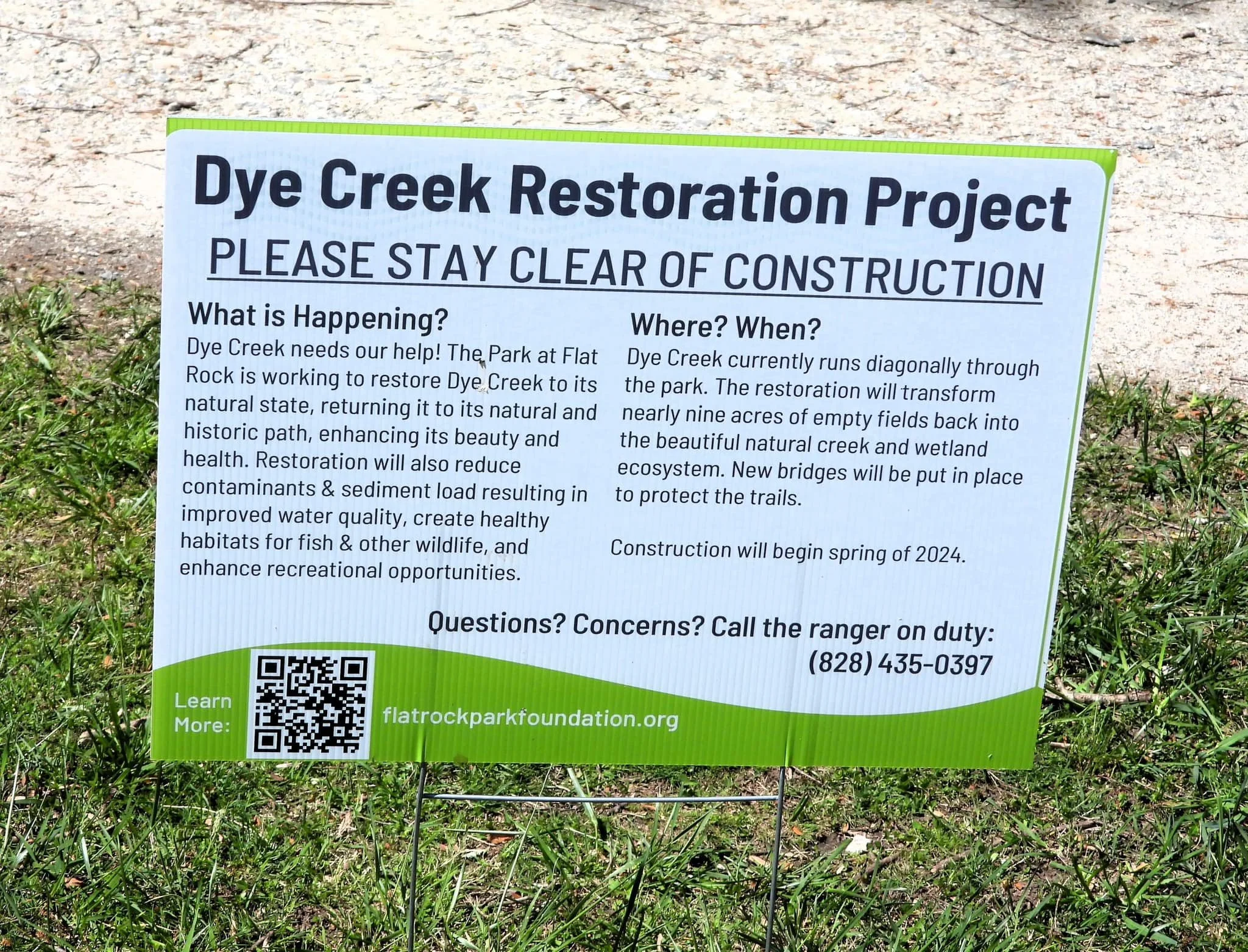
Sign at The Park explaining the Dye Creek Restoration Project
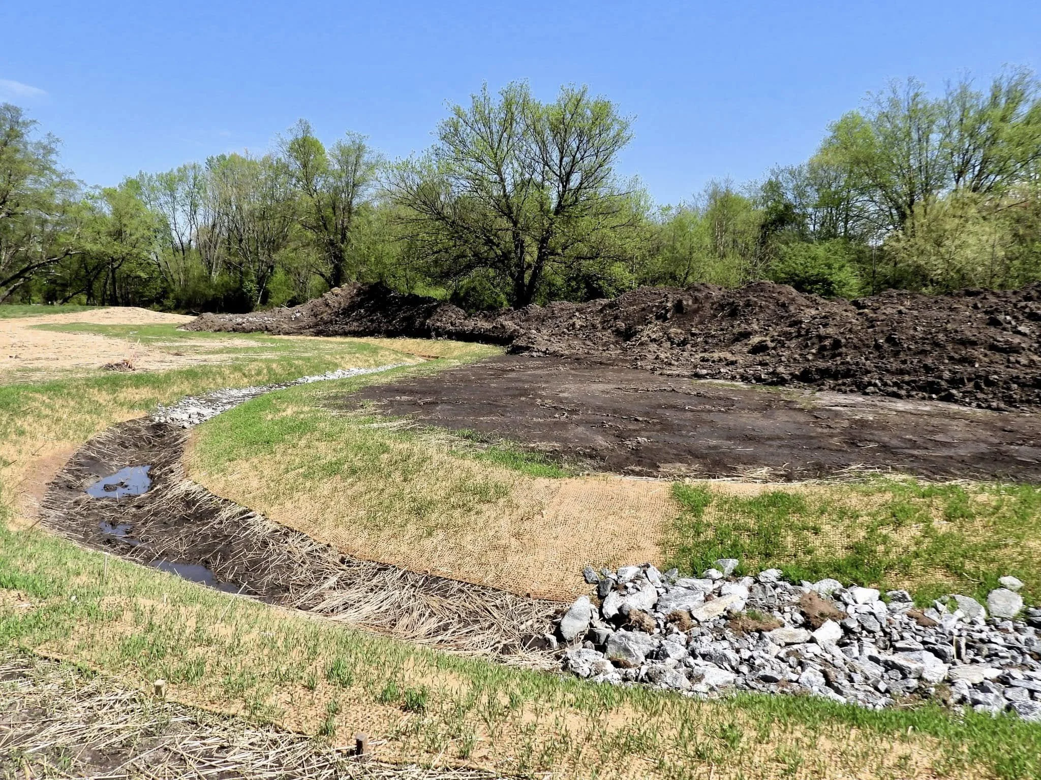
For generations, Dye Creek flowed naturally through the lowlands that now form The Park at Flat Rock. During the agricultural era, however, portions of the stream were straightened and channelized to improve drainage and create more usable land. Later golf-course development further confined the creek corridor and diminished much of the surrounding wetland character.
By the time The Park at Flat Rock was established, the effects of those changes had become increasingly visible. Sections of Dye Creek had become deeply eroded and unstable. Water moved too quickly through the straightened channel, cutting into streambanks and carrying sediment downstream. Native vegetation along the creek had diminished, water quality had declined, and the stream provided far less habitat for wildlife than a healthy mountain creek normally would.
Village leaders, environmental planners, and conservation partners recognized that restoring Dye Creek offered an opportunity not only to improve the health of the stream itself, but also to reconnect part of the property with its original ecological character.
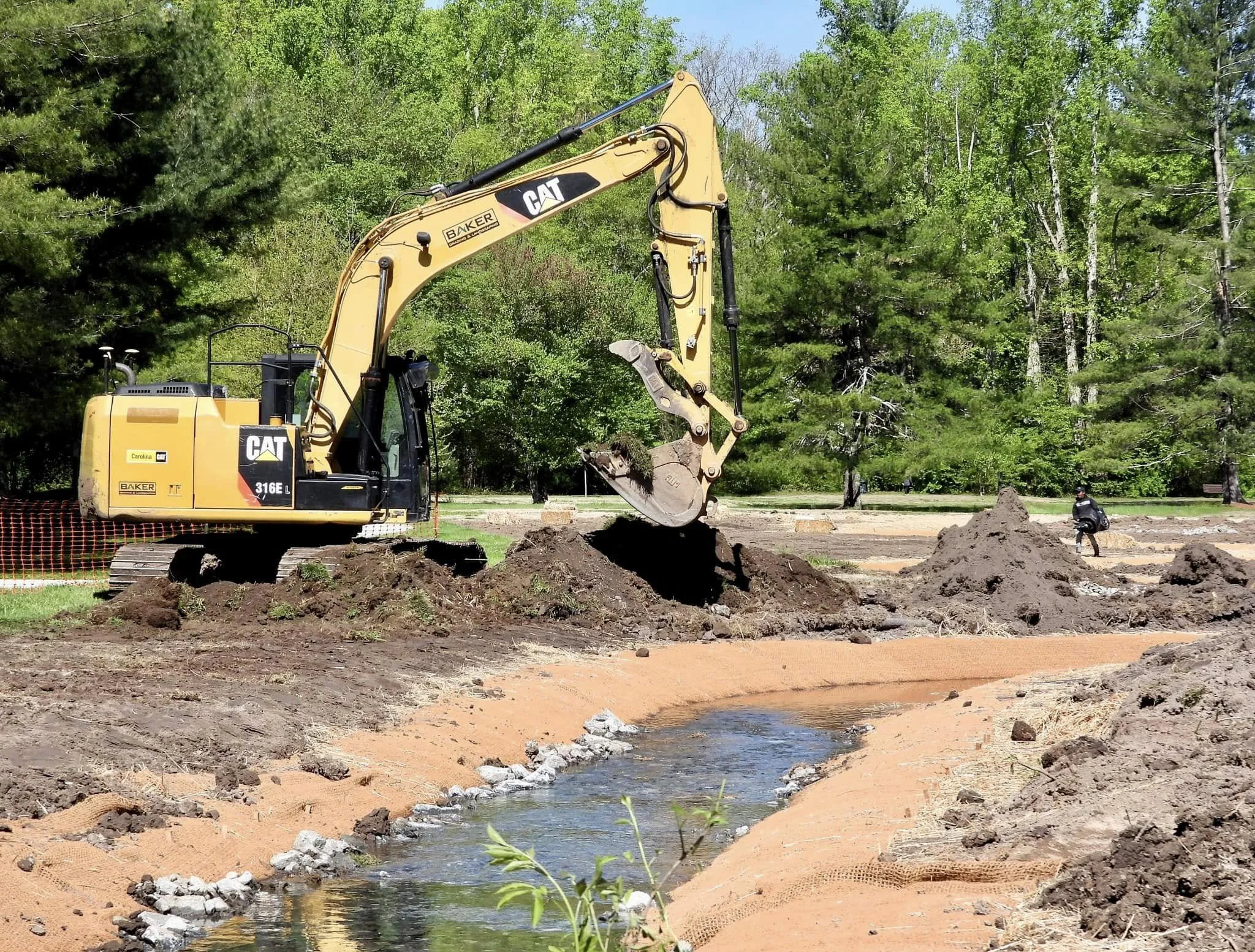
The Dye Creek Restoration Project formally began construction in March 2024. The project focused on more than 3,000 linear feet of stream and approximately eight to nine acres of surrounding landscape within the park. Major construction work was substantially completed ahead of schedule by June 2024, although additional plantings, bridges, educational signage, and trail improvements continued afterward.
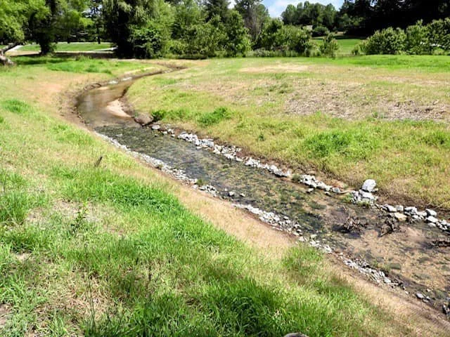
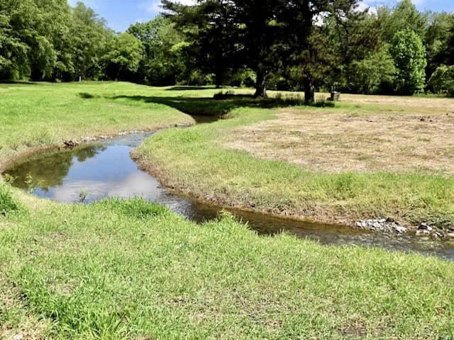
The scope of the project was extensive. Crews removed invasive vegetation, reshaped unstable streambanks, and reconstructed the creek into a more natural meandering channel. Instead of flowing through a straight ditch-like corridor, Dye Creek once again follows gentle curves through the landscape. The restored channel includes constructed riffles — shallow rocky sections designed to slow and aerate the water — along with pools, wetland edges, and expanded riparian buffers planted with native vegetation.
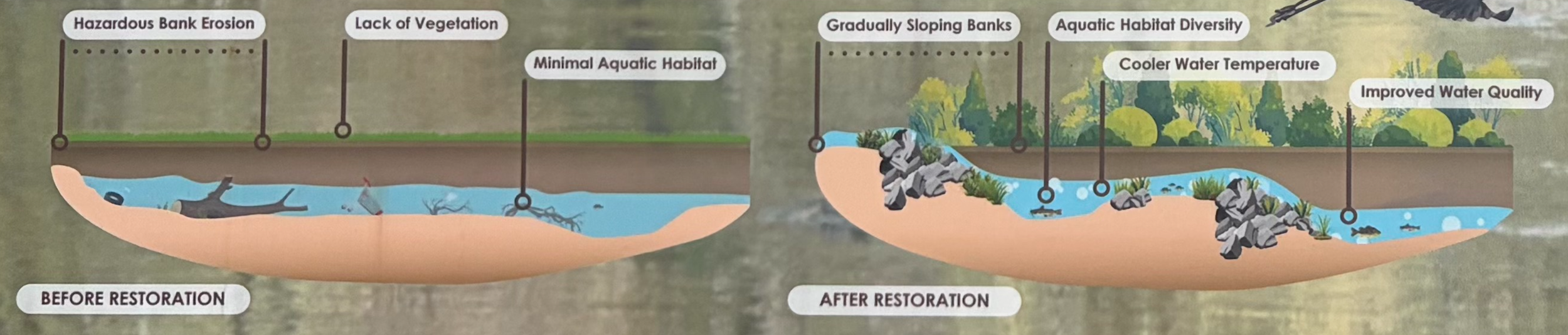
Graphic explaining the benefits of the Dye Creek Restoration Project
One of the primary goals of the restoration was to slow the movement of water through the creek system. In healthy streams, bends and riffles naturally reduce water velocity, allowing sediment to settle rather than wash downstream. Slower-moving water also reduces erosion and improves overall water quality. The restored riparian buffers shade the stream, helping maintain cooler water temperatures critical for aquatic life.
The ecological benefits extend well beyond the boundaries of the park itself. Healthier streambanks reduce sediment pollution downstream, while improved vegetation filters runoff before it enters the creek. Increased oxygen levels support fish, amphibians, aquatic insects, and microbial life. The restored floodplain and wetland areas also improve groundwater recharge and help absorb heavy rainfall during storms.
Interpretive materials at the park note that the project benefits watersheds extending “all the way to the Gulf of Mexico,” a reminder that even relatively small streams are connected to much larger river systems.
The restoration was also designed with public access and education in mind. New bridges, trails, overlooks, and interpretive signage allow visitors to experience the restored stream corridor while learning about the environmental history of the property. What was once an overgrown and deteriorating drainage channel has become one of the park’s defining natural features.
Funding for the approximately $475,000 project came from a combination of grants and local support. Major contributors included the North Carolina Department of Environmental Quality, the Community Foundation of Henderson County, and the Flat Rock Park and Recreation Foundation, a nonprofit organization established to support projects within the park.
In many ways, the Dye Creek Restoration Project represents the latest chapter in the long evolution of the property. For more than two centuries, the landscape was repeatedly reshaped by dams, agriculture, development, and recreation. The restoration effort reflects a different philosophy — one that seeks not to force the land into submission, but to work with the natural systems that first shaped this corner of Flat Rock centuries ago.
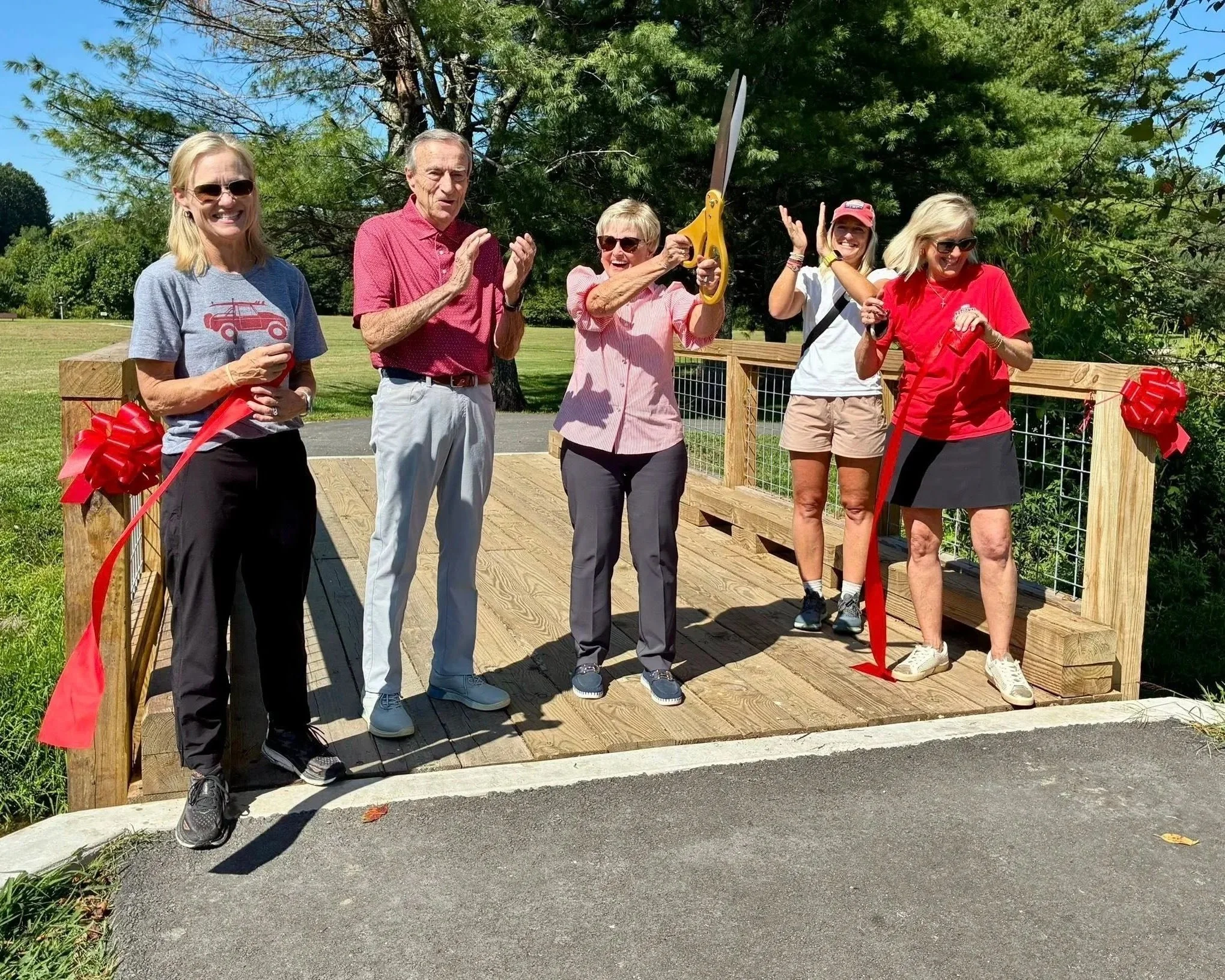
The Walker Family dedicating the Walker Bridge over Dye Creek.
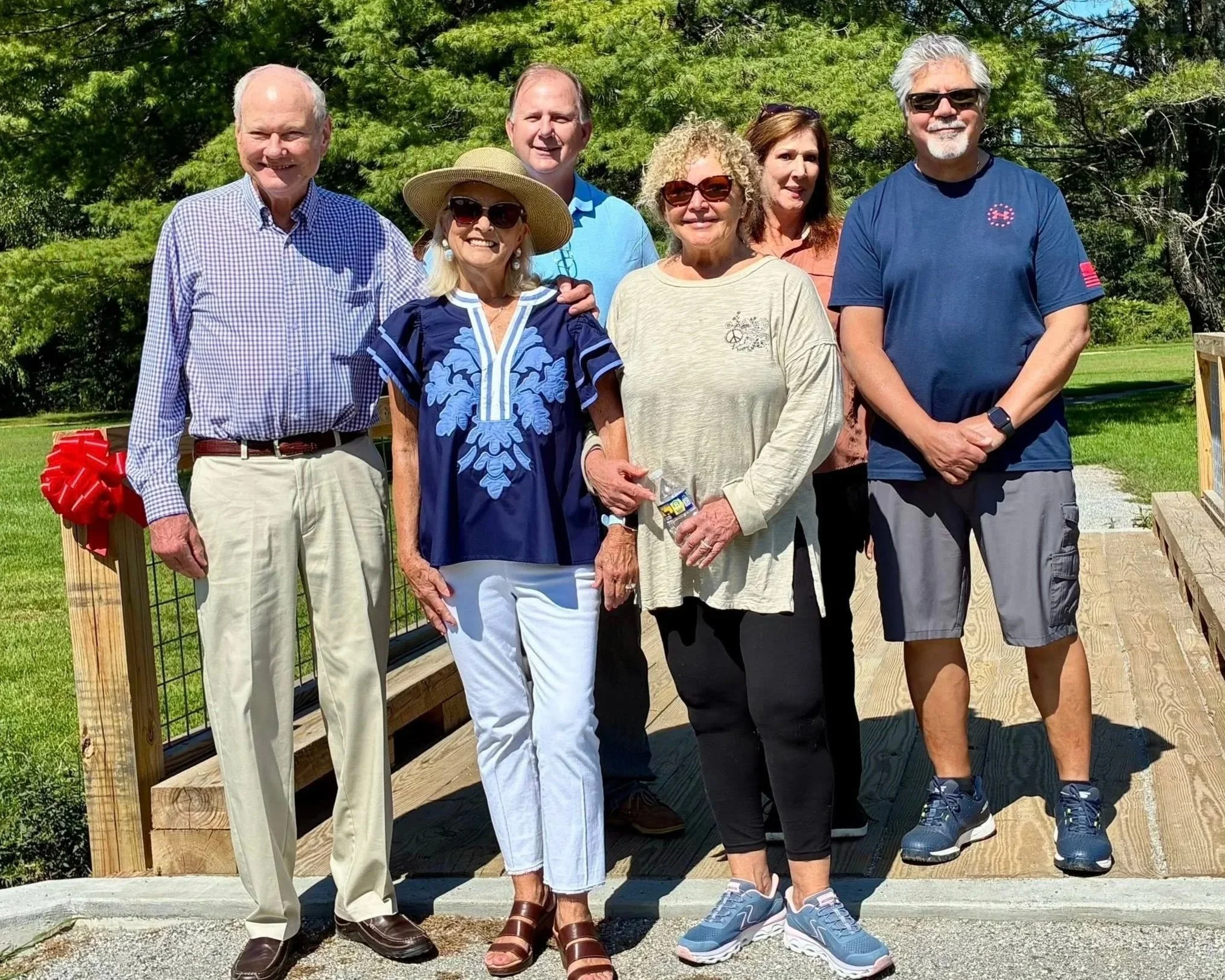
The Olson Family dedicating the Olson Bridge over Dye Creek.